
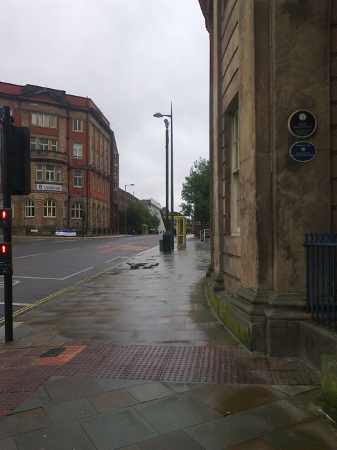
View from Roscoe's birthplace
I've mentioned the MossLake a few times, and thought this photo from the corner of Hope Street, where Roscoe was born, might illustrate.
The high point in this area is where I'm standing taking the photo, after which the rock structure forms a natural hollow between this point and Smithdown Lane. This was a natural collection point for moisture running down from higher towards Everton Brow, and the reason the peat and bog area was formed, the only escape for the water being in the two streams that lead off the fields, towards Otterspool to the south and via London Road and down into 'the pool' to the North. In the centre of this, on the land where Abercromby ward lies, unuseable ground of marshland and small lakes were cut through by footpaths to join the town to outlying villages, but the main routes in and out of Liverpool avoided the route until it was identified as expansion land and drained.
The high point in this area is where I'm standing taking the photo, after which the rock structure forms a natural hollow between this point and Smithdown Lane. This was a natural collection point for moisture running down from higher towards Everton Brow, and the reason the peat and bog area was formed, the only escape for the water being in the two streams that lead off the fields, towards Otterspool to the south and via London Road and down into 'the pool' to the North. In the centre of this, on the land where Abercromby ward lies, unuseable ground of marshland and small lakes were cut through by footpaths to join the town to outlying villages, but the main routes in and out of Liverpool avoided the route until it was identified as expansion land and drained.
 RSS Feed
