
It isn’t known quite when some of the lanes and streets out of Liverpool village were finally formed in their modern incarnations, but some still follow the routes of the earliest paths and tracks out of the Town centre. The basic route of Scotland Road was originally the northernmost navigable route for travel of any distance at all, with the South blocked by the Sea Lake and ‘the Pool itself’, but by 1600, to head out East after crossing the river you would look to the route of the current Duke Street up to Faulkner Street ( then ‘Crabtree Lane’), and over Moss-lake brook up Smithdown Road, or you would head up to Mount Pleasant and then up to Edge Lane or Prescot Road.
Mosslake Fields boundary 1796
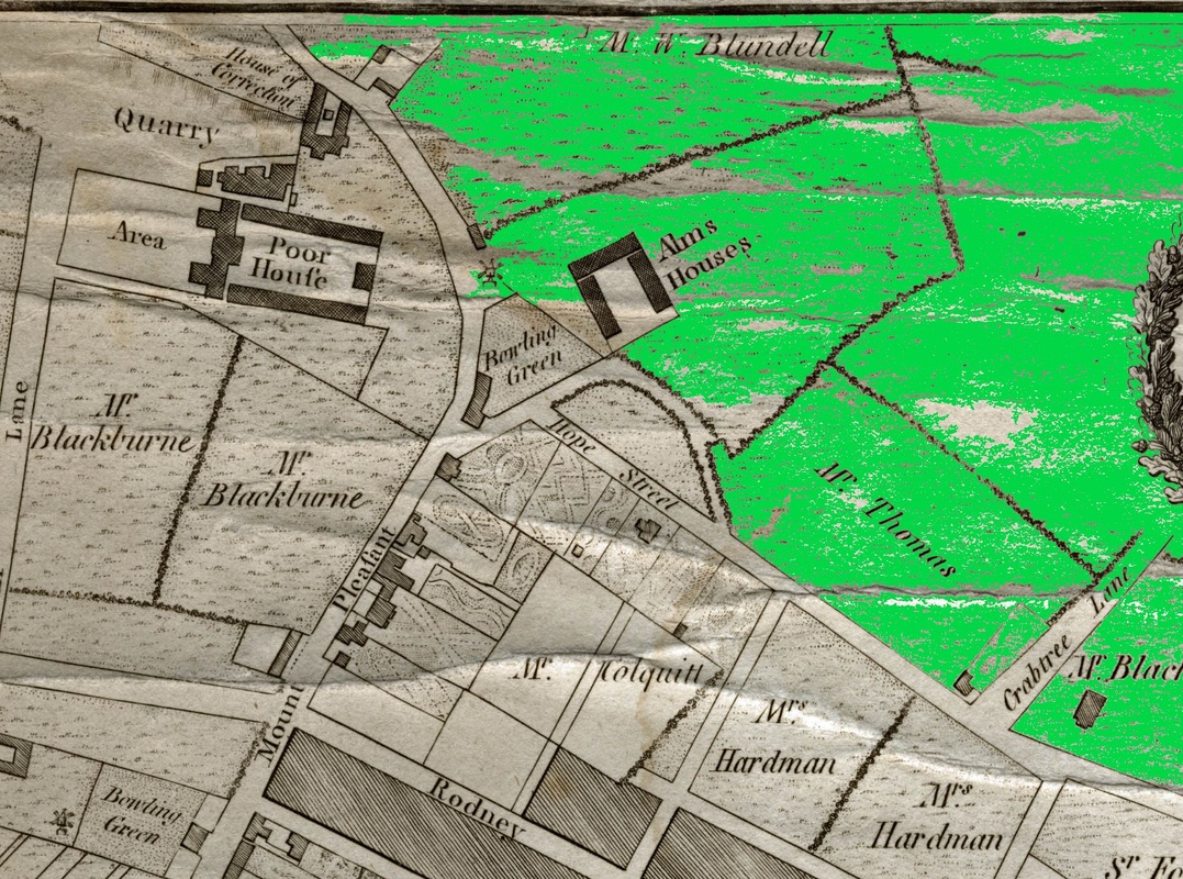
If you ever wondered why Mount Pleasant curves to the left around the Catholic Cathedral, this is because it follows the original pathway, and skirts around the edge of the Moss Lake Fields where they begin, just below Abercromby Square. It was at this turning point that Liverpool’s most famous ‘Bowling Green’ neatly slotted, at the end of Hope Street where the Liverpool Medical Institute now lives, next to the Everyman Theatre. And here that William Roscoe Snr had a tavern called ‘The Old Bowling Green House’, and that the younger William Roscoe, botanist, abolitionist and poet was born, his playground the Mosslake fields where Abercromby Square now sits. To digress on a digression, it’s often claimed that the more famous Roscoe grew up here, and tended his father’s market garden. Actually the Roscoe’s moved house within a year of Roscoe’s birth and a second, larger ‘Bowling Green’ tavern, complete with market garden, appeared further down Mount Pleasant, nearer Rodney Street and became the family home. Not hugely fascinating, but facts is facts, as they say. More of Roscoe later.
 RSS Feed
